


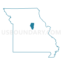
Voting District 31, Boone County, Missouri
About
Outline

Summary
| Unique Area Identifier | 607173 |
| Name | Voting District 31 |
| County | Boone County |
| State | Missouri |
| Area (square miles) | 57.39 |
| Land Area (square miles) | 56.10 |
| Water Area (square miles) | 1.29 |
| % of Land Area | 97.76 |
| % of Water Area | 2.24 |
| Latitude of the Internal Point | 38.73374510 |
| Longtitude of the Internal Point | -92.29484560 |
Maps


Graphs
Select a template below for downloading or customizing gragh for Voting District 31, Boone County, Missouri


Neighbors
Neighoring Voting District (by Name) Neighboring Voting District on the Map
- Voting District 26, Boone County, MO
- Voting District 30, Boone County, MO
- Voting District 32, Boone County, MO
- Voting District 35, Boone County, MO
- Voting District 42, Boone County, MO
- Centertown Voting District, Cole County, MO
- Guthrie Voting District, Callaway County, MO
- Holts Summit Rural/Cedar City Voting District, Callaway County, MO
- Jamestown Voting District, Moniteau County, MO
- New Bloomfield Voting District, Callaway County, MO
- Scott Station Voting District, Cole County, MO
Top 10 Neighboring County Subdivision (by Population) Neighboring County Subdivision on the Map
- Jefferson township, Cole County, MO (54,165)
- Summit township, Callaway County, MO (8,873)
- Three Creeks township, Boone County, MO (5,133)
- Cedar township, Boone County, MO (4,190)
- Marion township, Cole County, MO (3,823)
- Cedar township, Callaway County, MO (2,937)
- Linn township, Moniteau County, MO (1,292)
- Guthrie township, Callaway County, MO (604)
Top 10 Neighboring Place (by Population) Neighboring Place on the Map
Top 10 Neighboring Unified School District (by Population) Neighboring Unified School District on the Map
- Columbia Public Schools, MO (136,836)
- Jefferson City Public Schools, MO (71,991)
- Southern Boone County R-I School District, MO (7,932)
- New Bloomfield R-III School District, MO (4,232)
- Moniteau County C-1 School District, MO (1,409)
Top 10 Neighboring State Legislative District Lower Chamber (by Population) Neighboring State Legislative District Lower Chamber on the Map
- State House District 24, MO (46,896)
- State House District 20, MO (38,233)
- State House District 114, MO (36,525)
- State House District 117, MO (35,534)
Top 10 Neighboring State Legislative District Upper Chamber (by Population) Neighboring State Legislative District Upper Chamber on the Map
Top 10 Neighboring 111th Congressional District (by Population) Neighboring 111th Congressional District on the Map
Top 10 Neighboring Census Tract (by Population) Neighboring Census Tract on the Map
- Census Tract 17.01, Boone County, MO (6,909)
- Census Tract 706, Callaway County, MO (6,426)
- Census Tract 109, Cole County, MO (6,235)
- Census Tract 708, Callaway County, MO (4,533)
- Census Tract 17.02, Boone County, MO (4,306)
- Census Tract 206, Cole County, MO (4,021)
- Census Tract 3851, Moniteau County, MO (4,010)
Top 10 Neighboring 5-Digit ZIP Code Tabulation Area (by Population) Neighboring 5-Digit ZIP Code Tabulation Area on the Map
- 65203, MO (53,307)
- 65109, MO (38,090)
- 65101, MO (30,587)
- 65010, MO (5,704)
- 65063, MO (3,412)
- 65039, MO (2,328)
- 65023, MO (1,730)
- 65046, MO (1,194)